


MilitaryMaps app for iPhone and iPad
Developer: Vadim Logunov
First release : 30 Aug 2018
App size: 10.77 Mb
The mobile application of open interactive combat maps militarymaps.info is an opportunity to be aware of the main geopolitical events in the world directly inside of your phone:
Collaboration and openness of the map for all users makes it an indispensable assistant in todays rapidly changing world.
Created for joint work and analysis of the current situation, MilitaryMaps maps will help you navigate in geopolitical and military events with a link to the location. With the mobile application MilitaryMaps, you no longer have to guess where the events occur and why this or that event develops. Lines of fronts and boundaries of zones of influence, controlled areas and movements of equipment and forces, shelling and attacks - all this on-line in your phone. The mobile application will help you navigate in the current situation, and interactive notifications will not miss important events.
Fine-tune the interface will help you to select from the stream of information only what you are interested in:
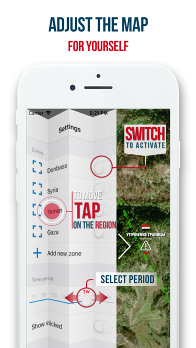
● ZONES: use preset ZONES or create your own by clicking on the "plus" in the left side menu. You can create any number of "Zones" in order to go to them "one click" - the map will move to the Zone and zoom. Activating the Zone, using the slider to the right of the name, will allow you to display on the map ONLY the events that occurred in the Zone.
*By default, all Zones are not active, which means that the map will display the situation throughout the world.
● PERIOD: Use the "Period" slider to set the time period, the events inside which you want to be displayed on the map. *Attention! Remember, the longer Period you choose, the more data will be downloaded to your phone when updated.
● STICKED: the switch allows you to display stationary object markers (important events and stationary objects: cities, roadblocks, etc.) on the map, which will be displayed regardless of the "Period" you have chosen.
*Attention! There are a lot of Sticked objects - we recommend to limit the number of markers on the map before activating the "Sticked" by using ZONE ACTIVATION or filters.
● FILTERS: Use type of marker filters to display only the types of events that you are interested in.
● SOUND: Use the Sounds switch to turn on/off sound effects inside the application.
The information in the application is updated automatically every 90 seconds.
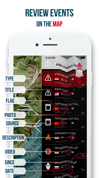
To refresh the information on the map, simply pull events down in the right sidebar.
To move to the event selected in the right side menu, just tap on it.
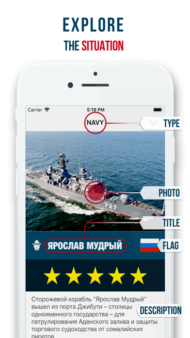
To learn the details of an event that occurred, click on the event marker on the map.
If the event has a source specified, then you may view it right inside application by taping on the link inside the Event details panel.
Install the app, share with friends.
* this is just the beginning, the functionality of the application will expand.